25 June 2011

Geraldton to Kalbarri 20/6 to 25/6

Coronation Beach & Campsite
After leaving Geraldton we were keen to get back into freestays so we headed 36 km north to Coronation Beach.  This beach, run by the Chapman Valley Council, has excellent facilities.  It has a  very safe swimming beach and we spent an enjoyable two days here. 
The view north from Coronation Beach
There are times when being away from home is quite difficult, especially when we miss family birthdays.  However on the 21st our thoughts were definitely with Eloise, who was booked into hospital to have her tonsils removed.  Thinking of you Ellie – get better soon.  Our thoughts were also with the family as they met and celebrated recent birthdays for Ryan, Georgia, and Eloise.  Also a very special Happy Birthday to Seamus who turned 21 this month.  Our thoughts are also with Trevor after his recent knee replacement surgery.  Hope he's a better patient than Mark would be!
St Mary's Church Northampton


Travelling towards Kalbarri we stopped for morning tea at Northampton.  This town features another two of Monsignor Hawes buildings – a convent and church and both buildings were ornate and very well preserved. 

Port Gregory
Pink Lake - Hutt Lagoon
We also drove to Port Gregory.  It was difficult to understand how this town was ever used as a port, as there is a reef just past the shoreline.  Not surprisingly it was closed as a port after a number of ships sunk while attempting to move into port.  It is also well known for the ‘Pink Lake’ which is Hutt Lagoon. This lake is pink due to the amount of betacarotene which naturally occurs and is processed in this area.  There is also an open cut garnet mine in Gregory.


Lynton Convict Hiring Station

Sanford House
Our overnight stay was at Lynton Station (Linga Longa Farmstay).  Ed made us very welcome even organising a fireplace and timber for a fire.  This station is on the site of the Lynton Convict Hiring Station (1853) and other convict ruins.  Prisoners – most of them ‘ticket of leave’ men - were brought to this station to be hired out as labour for the Geraldine Lead Mine and to Station Owners in the region.  Major Henry Sanford played a major role in developing this hiring station as well as maintaining his role in whaling, mining, growing crops and breeding stock.  With the help of convicts he built a two storey home with views of the coastline.  Newspaper articles of the time described Sanford House as a “magnificent villa” and this heritage listed building is slowly being restored, as are some of the derelict convict buildings.  As you can see from the picture below, the prevailing wind direction can be easily spotted and provides further evidence as to why W.A is known as 'Windy Always'.
What direction are the prevailing winds?
Castle Cove

Natural Bridge

Grandstand
 Moving on to Kalbarri there were many places to pull over and admire the scenery of the Kalbarri National Park.  This is a spectacular coastline, with coastal gorges which feature towering cliffs that plummet to the waves below.  We stopped at Castle Rock, Natural Bridge, Island Rock, Eagle Gorge and the amazing Red Bluff, which are just off the highway leading into Kalbarri.  The rusty red cliffs here have been used for centuries as a signpost for sailors that they have reached this particular spot on the coast.  It is a shame we can’t send you a real life recording of the sound of these large waves CRASHING onto this spectacular coastline.
Red Bluff
Hawks Head Canyon
Ross Graham
Donna after the walk down the canyon!
After setting up at Kalbarri, we headed off without the caravan to the river gorges of the Kalbarri National Park.  The Murchison River has carved magnificent red and white banded sandstone gorges that stretch for 80 kilometres as it makes it way to the wonderful Indian Ocean.  Our first stop was Hawk’s Head where we stood open mouthed at the vista in front of us.  From there we went to the Ross Graham Lookout and trekked down to the river. Note: As this photo shows, Donna was a little tired following a long day visiting these gorges!


On our second day in Kalbarri we ventured back into the National Park to see ‘Nature’s Window’, the ‘Z Bend’ and to walk ‘The Loop’.  Hopefully the photos will show you how spectacular these gorges are;  however I’m sure they can’t accurately reflect the vast array of colours displayed by the sandstone gorges in this national park.  
Nature's Window
Mark at The Loop
Murchison River - Loop Canyon

Z-Bend


Donna at 'The Loop'

 This town also gave us another opportunity to get back on our bikes and explore the beautiful coastal scenery of Kalbarri.
Murchison River Mouth

While the days here have been really beautiful, last night we had an interesting weather event.  We went to sleep to the sound of gentle rain and then woke suddenly very early in the morning, to the sound of the wind roaring through the treess.  Then we had a downpour that lasted only a few minutes. It was only in the morning that we found out that three caravans in the park had lost their awnings during these short wind gusts.  They said it was like a mini tornado.  Luckily we were in a more protected area!  
Farewell from beautiful Kalbarri
As you can see from this photo - life can be tough on the road.  But we'll try our hardest not to weaken!

18 June 2011

Geraldton 13/6 to 19/6

Pt Moore Lighthouse
We’re staying in a caravan park in Geraldton as we wanted to catch up with family and watch the State of Origin.  It seems like everyone we talk to in this caravan park is here to have repairs done – either to cars or caravan or both!  So far everything has gone well with both our cruiser and caravan....touch wood!
Town Beach
Back Beach - Windsurfer & Ship
Geraldton is, of course, on the coast.  It is yet another port city and we can see at least six large ships waiting off shore at the moment and a further three ships being loaded in the port.  There is a cycle/walking path along the coastline from Sunset Beach (where we’re staying) past the port and to the southern beaches.  Because of the wind over the last few days on the northern beaches there was a lot of seaweed deposited on the beach and it seemed like all the sand had ended up on the more sheltered southern beaches.  Of course we also saw the iconic lighthouse at Moore Point. 
  After changing our bike tubes to the ‘puncture resistant’ type and inserting green slime to hopefully prevent any more punctures, we enjoyed a bike ride beside the seaside into the city centre and beyond. 

St Francis Xavier Cathedral

Interior of Cathedral
 There is also a lot of history in Geraldton.  We did a tour of the St Francis Xavier Catholic Cathedral.  Our tour guide was a wonderful lady who was absolutely committed to imparting her knowledge about the cathedral and its architect – Monsignor John Cyril Hawes.  He was born in England and became an Anglican minister before converting to Catholicism and studying for the priesthood.  After being invited to Western Australia to help as a missionary, he undertook the building of this cathedral and fifteen other buildings in the diocese.  He was a talented craftsman, sculptor, stonemason, horseman, poet and painter.  After leaving Western Australia he lived in the Bahamas on Cat Island as a Franciscan Hermit.  A very interesting man, who left a legacy in this state in the forty years he lived here.  What amazed us were the colours inside the cathedral.  I have never seen so much orange in a church - before!  Although our guide did say that the original colour may have been more like ochre.  
Another of Monsignor Hawes Bldgs - Now Nazareth House


Lighthouse Keeper's House
Old Victoria Hospital
We also visited the old Victoria Hospital and Gaol and loved talking to the little old lady from the Historical Society at the ‘Old Lighthouse Keeper’s House’.


 Of course we also visited the magnificent HMAS Sydney II Memorial.  This memorial has many different elements which we were very lucky to have explained by one of the volunteer guides from this city.  The memorial is dedicated to the memory of the 645 men who lost their lives on the HMAS Sydney on the 19th of November, 1941 and to the sacrifice they and their families made to ensure the security of Australia.  The main elements include a cupola of 645 seagulls each touching the other all rising towards the sky – representing the seamen who lost their lives and remain together on the seabed even today.  The importance of this as a national memorial is represented by the seven pillars – one for each state or territory of Australia.  I found the ‘Waiting Lady’statue of the lady waiting for her loved ones to return really embodied the way that the families of the sailors waited so long for news of their families and of the disaster itself.


We also spent hours at the Museum of Western Australia.  Because this is the Batavia Coast, reading about the Batavia and the massacre that ensued afterwards was more meaningful in this city so close to the disaster.  However we also learnt a lot more about the local area itself – including the indigenous people, the animals and the mining industry.  
Batavia Marina

Reflections - Chapman River Geraldton

14 June 2011

Guilderton to Geraldton 6/6 to 13/6

Finally we feel like we are heading northwards.  We’re travelling along the Indian Ocean Drive and now we feel that we really are on our way to Broome and beyond. 
Moore River, Sea & Caravan Park at Guilderton
Anyone for a dance?
 We stayed for two days at Guilderton, a sleepy seaside town during the week, however on the weekends, because of its proximity to Perth it is usually full to the brim.  Old seaside shacks have given way to modern villas overlooking the sea or the inlet. The town’s name was derived from Dutch guilders which were found in the area, due to the shipwreck of the ‘Vergelde Draeck’ (Gilt Dragon) in 1656.  The Moore River flows into the sea at Guilderton, however it only flows through the inlet after a deluge.  At present a sand dune about 20 metres wide lies between the sea and the river.  The caravan park in which we stayed is situated right on the inlet.  Metal sculptures around the township make for interesting bike rides or walks.  For those golfers, Guilderton also has what we have been advised is a ‘superb’ 9 hole golf course, for which you pay $10 for either 9 or 18 holes of golf.  A town well worth a visit if you are travelling this way.

From Guilderton we travelled to Cervantes, a town based on crayfish farming.  On the way we stopped at:

View from lookout at Seabird


Seabird (a tiny seaside village)


Beachside Shelter - Ledge Point


 Ledge Point (a very go-ahead and scenic town noted for its windsurfing.  Lots of building going on and a brand new caravan park);


Lancelin Jetty
Lancelin (Cray fishing village with lots of boats and a well used jetty);
and


Pinnacles

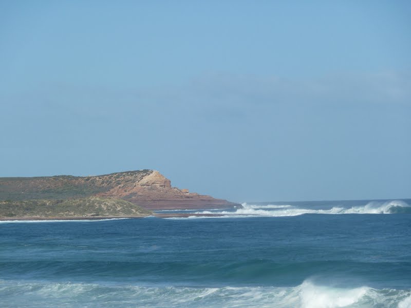
Nambung National Park noted for The Pinnacles.   The Pinnacles are thousands of limestone pillars that have been formed by the wind blowing the sand away from tree roots, which resulted in the solid limestone rock appearing.  They are about 80,000 years old and the tallest Pinnacle is 4m. There are about four thousand jagged, sharp edged pillars rising out of the desert floor. These amazing structures really blew us away.  It reminded us of a lunar landscape and these limestone pillars seemed to  appear out of nowhere.


Hansen Bay, Cervantes
Prospector in Cervantes
Cervantes is on the mainland east of the Cervantes Islands.  Originally thought to be named after the Island Chain,  it was later realised that the chain itself was named after the shipwreck of ‘The Cervantes’ which occurred in 1840.  (Amazing how history reinvents itself after a while)  This shire has banned free camping, meaning that the caravan parks are very well used or caravanners choose to bypass it entirely.  This town relies on rock lobster fishing for its survival.  Live lobsters are transported to other centres for export overseas.  
Cervantes Sunset

After leaving Cervantes we continued on the Indian Ocean Road towards Dongara.  On the way we stopped at what had been described in the tourist brochures as ‘blissfully relaxed fishing villages’, however the new road from Perth has seen a dramatic increase in the population of these towns.  In each there were large new housing estates and wonderful new amenities on the waterfront.  These included parks, gardens, bbq, walking and bike tracks and playgrounds.  The councils must be very happy with the increase in population.

Beach at Jurien Bay
Our first stop was Jurien Bay which has one of the newest Marine Parks in Western Australia.  It is sheltered by a string of islands and reefs and approx 20% of WA’s sea lions live and breed in this area.


Dynamite Bay - Green Head

 Then we visited Green Head.  Had lunch at a new pavilion overlooking Dynamite Bay. This was a picturesque little bay that would be ideal for swimming and snorkelling. 


Leeman
Our next stop was Leeman which was another town that had a large fishing fleet.  Obviously the western rock lobster season has not closed there yet!


Campsite - Cliff Head North
Sunset & Gas Platform
We finally reached our stop for the next few days at a freestay called Cliff Head North.  It’s about 35km south of Dongara, on the Indian Ocean Drive.  We’re only about 15 m from the beach, sheltered by a cliff and sheoaks with the best view of the ocean.  We were surprised to see a gas drilling platform and a patrolling navy boat out to sea in this area.  It was great to be able to enjoy a campfire again after staying in caravan parks lately.


We enjoyed a wonderful two days at Cliff Head North, but as there was a gale force wind forecast for Geraldton in a few days, we decided to head there earlier than planned and ensure we were set up before the onslaught!  On the way we stopped at:
Irwin River & Sea - Dongara
Dongara- Port Denison, twin towns which are separated by the Irwin River.  Enjoyed a stroll through the local museum which started its history as a police station, courthouse and jail.  Ironically, even though a new police station has been built next door, because of overcrowding they often hold court proceedings in the old museum.


Leaning River Gum Greenough (Direction of  prevailing winds?)
Greenough was a farming community and no land had been set aside for a township. After a Government Building was built at ‘Stony Hill’ in the early 1880’s other buildings sprang up!  This area is now known as Central Greenough and is a historic settlement run by the National Trust.  We spent an hour learning about the history of this area.  Mark was taken back to his childhood when we found the cane in the schoolhouse.  It brought back quite a few memories.  We were also pleased to hear that both the Anglican and Catholic Churches still hold services in these buildings and that the hall is still used for local celebrations.
Donna in old schoolhouse
Police Station & Gaol - Central Greenough
St Peter's Church - Central Greenough
 We arrived at Geraldton in the early afternoon and were exhausted after a day of acting the tourist so Mark was looking forward to Beer O'Clock!
Mark - Beer O'Clock

Mark - Still Beer O'Clock !